Engineering geological investigations
- Engineering geological site description (underground and overground) by using conventinal rock mass characterization systems: RMR (RMR89 and RMR14), SMR, MRMR, Qindex, QTBM, Q-slope, GSI, RMi.
- Using unconventional methods: in case of examining high natural rock cliffs we are mixing some input parameters from the above enumerated classification methods and during the charcterization of failure mechanism we are using the new developed method by Nick Barton, when we are replacing critical tangential stress with failure by extension and we are using the critical cliff height.
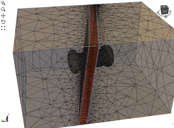
For other unconventional constitutive models (for instance: DISL, CWFS, DFN etc.) we are able to collect numerous other parameters which are not included in the conventional rock mass characterization systems and which can be outlined differently for each site specific projects.
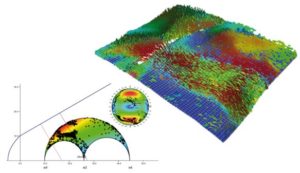
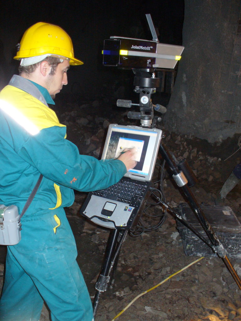
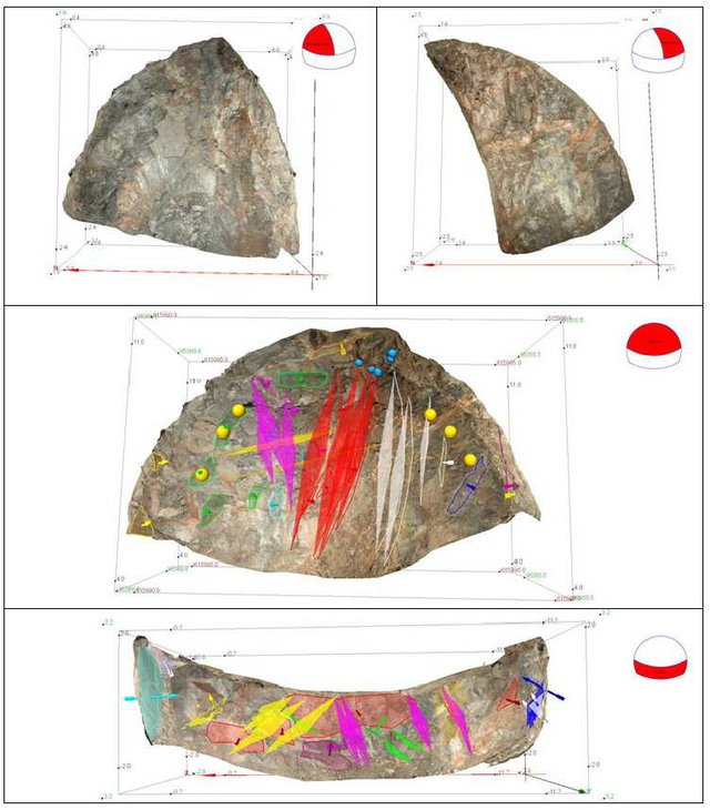
- The field mapping is supported by 3D photorealistic models. The models are prepared by using very dense point clouds, dense wireframes with matched stereophotos. By using several algorithms we are able to examine automated structural geological analysis. Based on the open source and free codes we can produce user interfaces as desired or we can offer the using of JointMetriX3D or ShapeMetriX3D conventinal systems.
- Drill core logging (RQD, Kiruna man made or automated, Q, RMR, GSI) and sampling for laboratory measurements.
- Design and interpretation of rock mechanical laboratory measurements (by using conventinal software background and self developed codes).
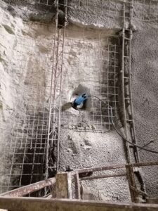
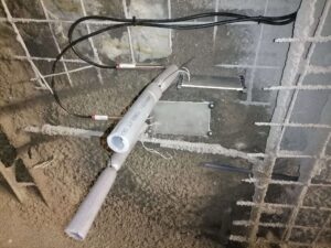
- Design and installation of Geotechnical Monitoring instrumentation (Inclinometers, Borehole Extensometers, Tilt Meters, Load Cells – NATM, Piezometers etc.)
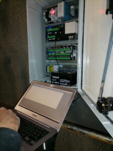
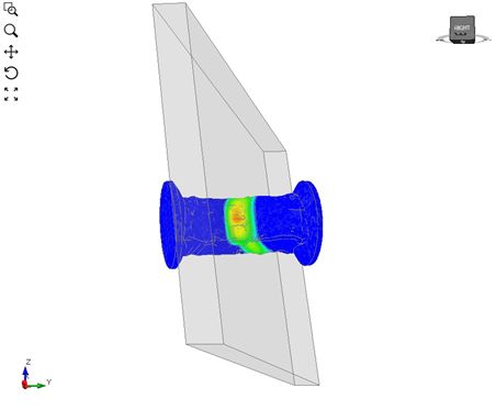
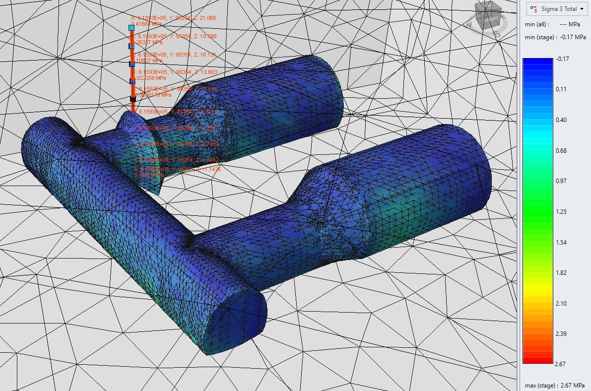
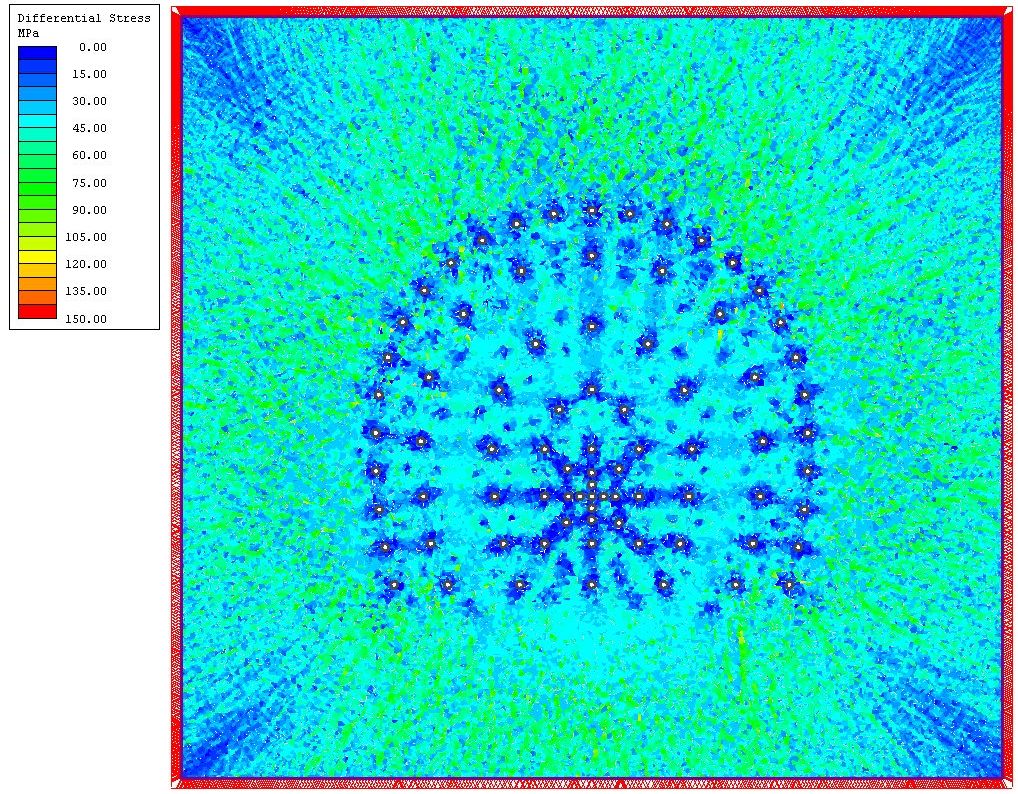
- Interpretation and analysis of in situ measurements which are related with engineering geology and rock mechanics, by using analytical and numerical modelling approaches.
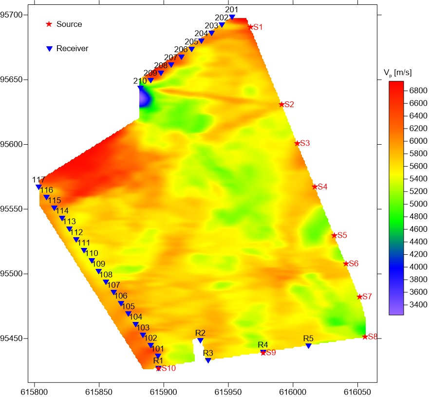
- Design and supervising of seismic measurements
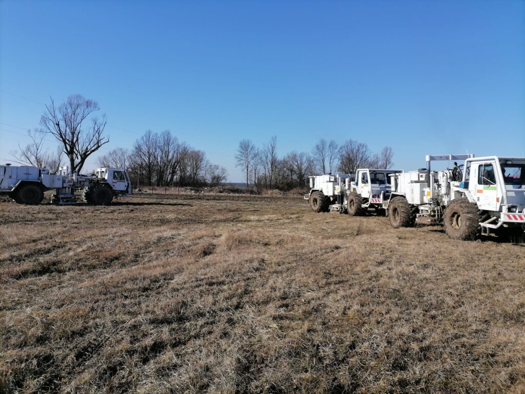
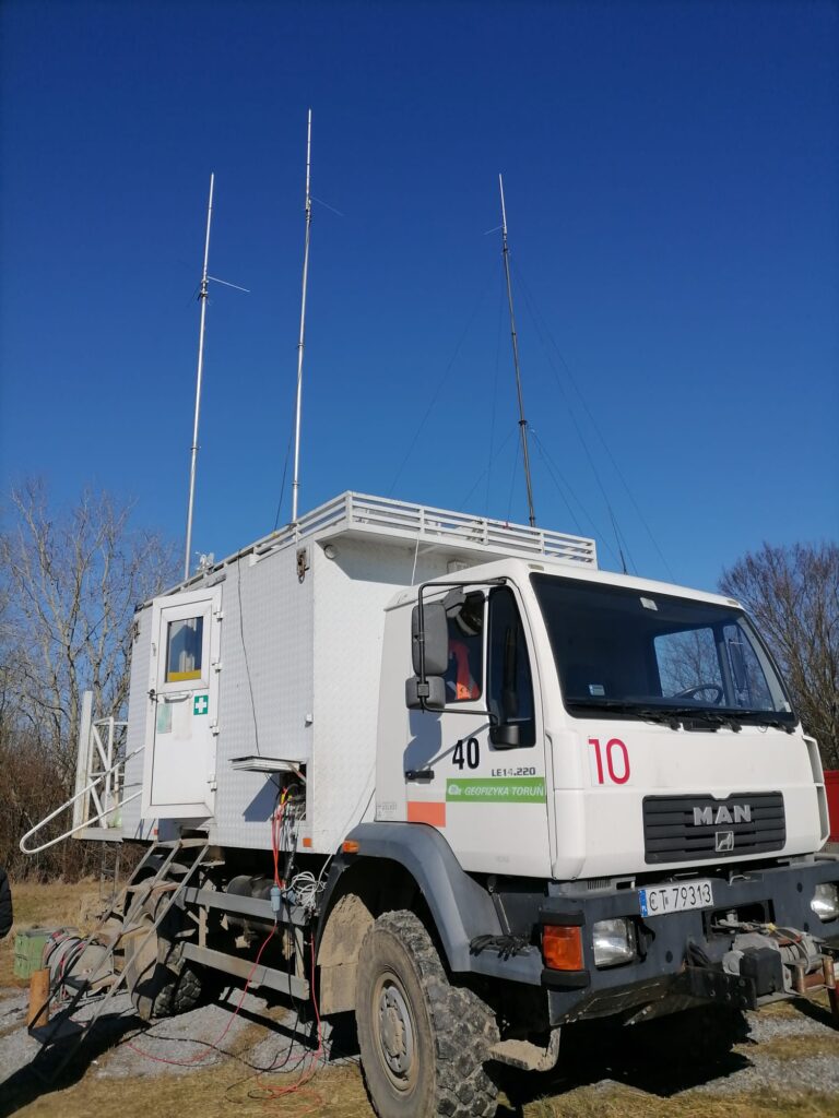
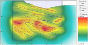
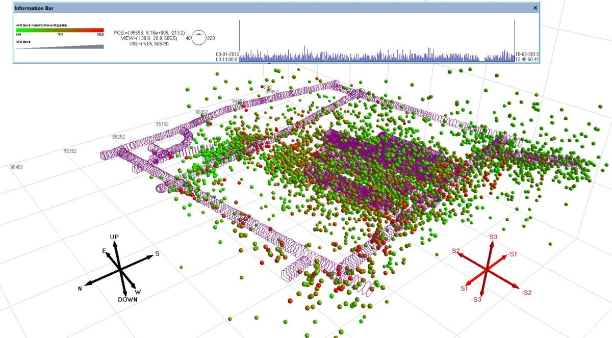
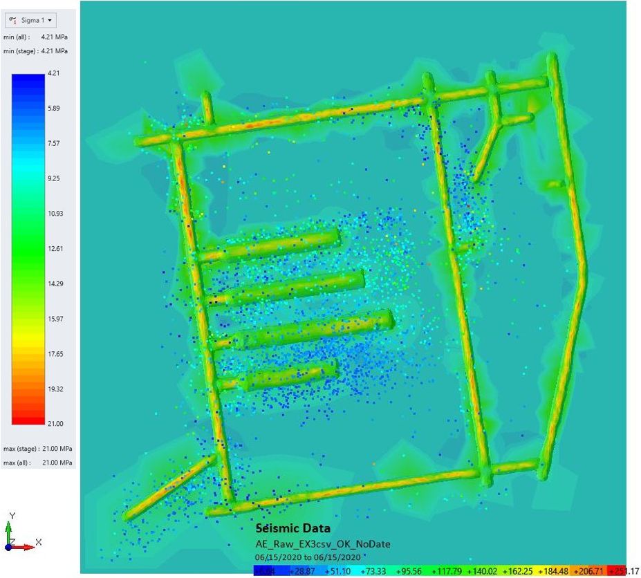
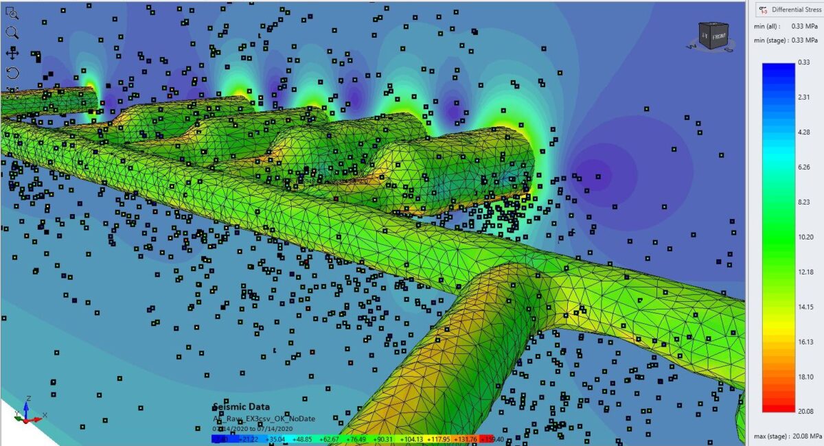
- Interpretation and analysis of geophysical measurements – seismic and EM profiling. Downhole, crosshole measuremnts. Tomography by using surface and underground measurements. Examination of seismic (earthquake), microseismic and acoustic emission datasets.
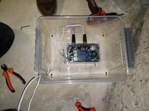
- Design and installation of earthquake mesurement systems (for instance Nanometrics and RaspberryShake seismograph systems)
 Back analysis of in situ measurement results by using analytical and numerical modelling solutions.
- Interpretation and examination of excavation damaged zones (EDZs) around underground excavations.
Tunneling
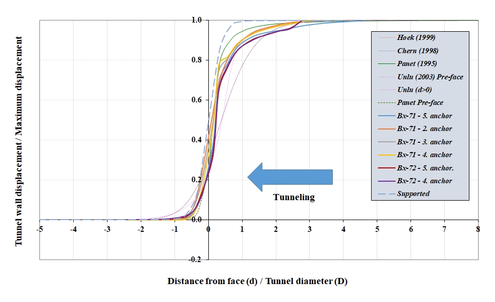
- Design capabilities: excavation phases, tunnel support, complete in situ monitoring measurements, pre- and post grouting.
- Site supervision capabilities: tunnel support, grouting, in situ measurements.
- Execution of in situ measurements: MPBX extensometer measurements; inclinometer measurements (horizontal and vertical directions); strain measurements; in situ stress measurements;
Geology
- Structural geological mapping and site characterization (by using alpinism techniques and high tech mapping solutions).
- Drill core logging and sampling.
- Microscopy: structural geological and petrographic descripions.
- Global and regional tectonics interpretation.
- In situ stress prediction based on the geological knowledge if there is no available in situ measurements.
- In situ stress measurements interpretation by taking into account the stress history based on the geologcal timescale and tectonic history.
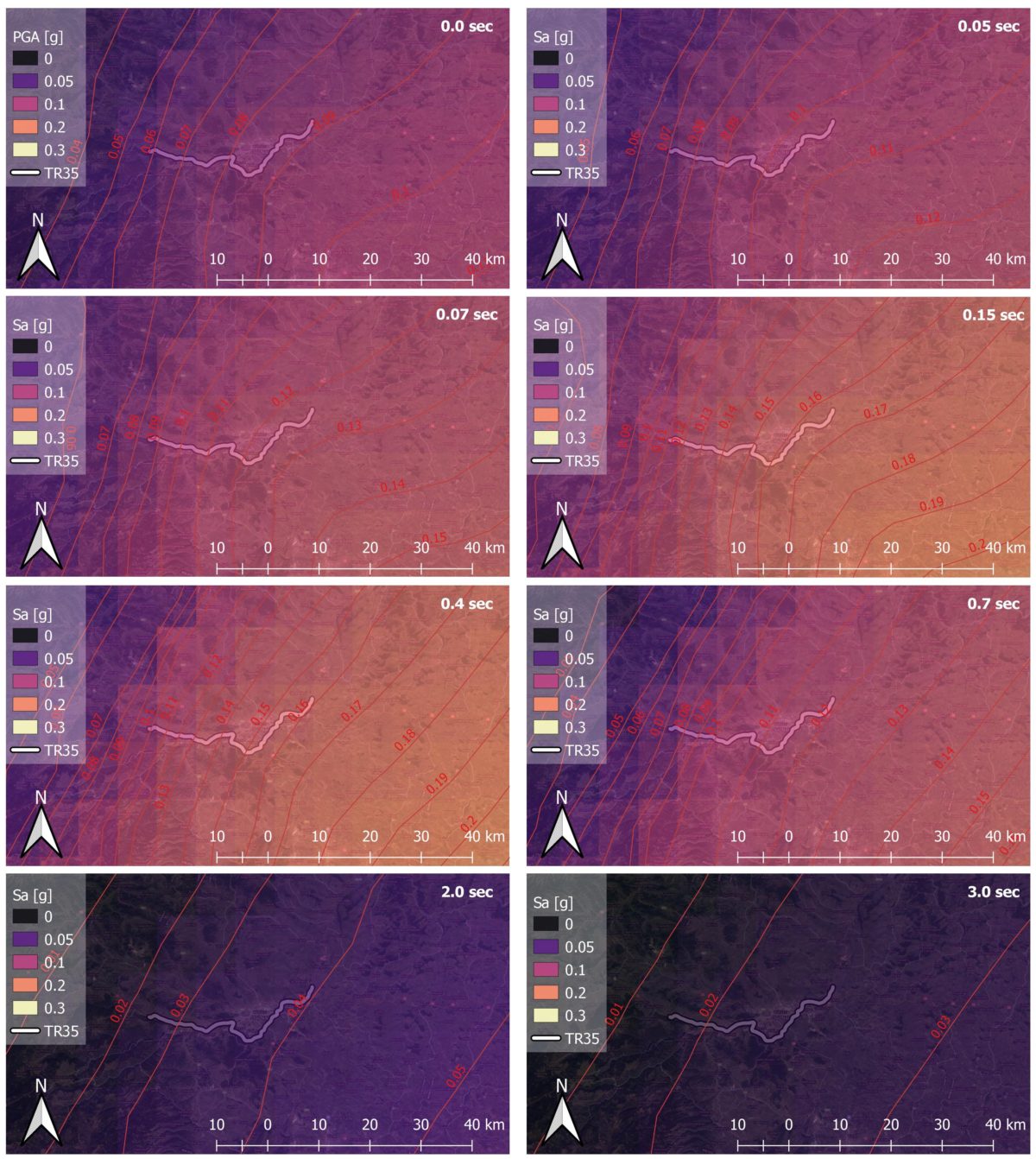
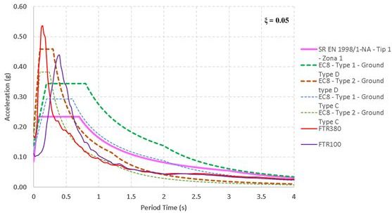
- Earthquake hazard evaluation by using probabilistic and (or) deterministic seismic hazard methods (PSHA and DSHA)
- Focal mechanism studies of earthquakes, microseismic and acoustic emission data.
- Integration all existent data in one software (for instance into Move – currently we do not own it) and to provide well-supported solutions for the following fields: stratigraphy, petrography, geomechanics, geodynamics.
- Developing appropriate geological background for detailed earthquake hazard evaluations.